非洲大陆最南端厄加勒斯角,也是大西洋与印度洋的界线北起点(并非大家更熟悉的好望角)
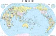
上小学时,我们就学过,世界海洋,共分为四大洋。
可是,很多朋友,包括许多地理老师都不太清楚:“四大洋各自包含哪些海,分界线是哪?”
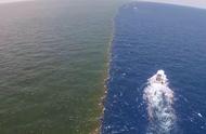
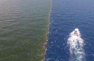
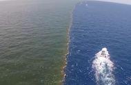
因为海洋不像陆地,有明确清晰的可见分界线。
看到网上众说纷纭,玫儿在此科普一下。
本文对海洋划分标准:采用国际水文组织(International Hydrographic Organization)对四大洋的划分。
2000年IHO将南冰洋定为大洋,之后IHO的资料中都称五大洋,但是我国仍然采用四大洋说法,所以本文还是讲解四大洋。不过本文会在最后介绍南冰洋。
The International Hydrographic Organization (IHO) is the inter-governmental organisation representing hydrography.
A principal aim of the IHO is to ensure that the world’s seas, oceans and navigable waters are properly surveyed and charted. It does this through the setting of international standards, the co-ordination of the endeavours of the world's national hydrographic offices, and through its capacity building programme.
The IHO enjoys observer status at the United Nations where it is the recognised competent authority on hydrographic surveying and nautical charting. When referring to hydrography and nautical charting in Conventions and similar Instruments, it is the IHO standards and specifications that are normally used.

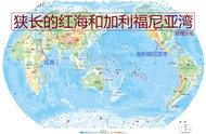
总图。红色线,就是四大洋的分界线
下面开始详细讲解!!!
为您上传更清晰的分图~~
太平洋与北冰洋的界线:亚欧大陆最东端 —— 美洲大陆最西端

白令海峡界线:亚洲大陆最东端杰日尼奥夫角Мыс Дежнёва(北纬66°4′45〃、西经169°39′7〃)和美洲大陆最西端威尔士王子角Cape Prince of Wales(北纬65°35′47〃、西经168°5′5〃)之间的连线。(分界线与海峡中两个小岛无关)
太平洋与印度洋分界线北段:马六甲海峡-马来群岛西南海岸(各岛之间的海峡基本都属于太平洋) —— 帝汶海和阿拉弗拉海分界线

马六甲分界线:亚洲大陆最南端皮艾角Tanjung Piai(北纬1°15′58〃、东经103°30′39〃) —— 小伊乌岛Pulau Iyu Kecil(北纬1°11′28〃、东经103°21′11〃) —— 小卡里蒙岛Karimun Kecil(北纬1°9′59〃、东经103°23′20〃) —— 克达布角Tanjung Kedabu(北纬1°5′36〃、东经102°58′37〃)之间的连线。(朗桑、直名丁宜、望加丽这几个岛之间以及它们和苏门答腊之间的水道,属于太平洋)